Nautical Charts
Explore the vast ocean and navigate with ease using these nautical charts. Whether you're an avid sailor or simply enjoy boating as a hobby, these charts are essential tools for plotting your course and ensuring a safe journey. With detailed maps that highlight coastal areas, water depths, and navigation aids, these nautical charts offer the accuracy and reliability you need to confidently set sail. From the open seas to serene lakes, find the perfect chart to suit your navigational needs and embark on unforgettable maritime adventures.
Sort

Nautical Charts
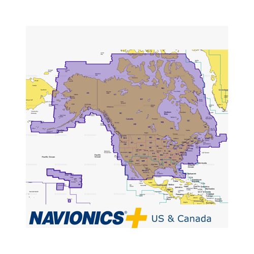
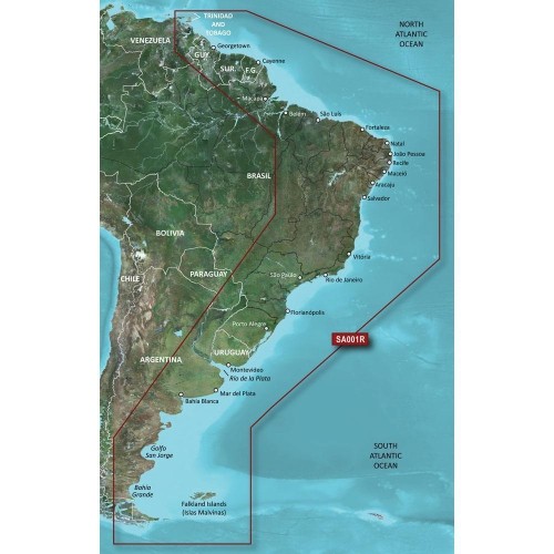
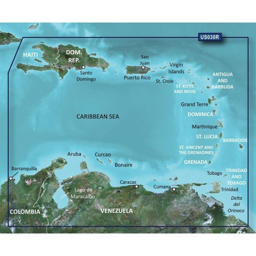
Navigating Canada’s vast and varied waterways—whether you’re charting a course across the Great Lakes, exploring the rugged coastlines of British Columbia, or threading your way through the intricate inlets of the Maritimes—calls for reliable, up-to-date nautical charts. These charts are more than just maps; they are essential companions for mariners, anglers, sailing enthusiasts, and even casual boaters who want to ensure safe passage and maximize their time on the water. Nautical charts display the contours of the seafloor, mark water depths, and highlight potential hazards such as rocks, sandbars, and submerged wrecks. They also indicate the locations of aids to navigation, such as buoys, markers, and lighthouses, which are crucial for plotting a safe and efficient route. With Canada’s winter months bringing unique challenges, such as shifting ice and variable visibility, having a trustworthy chart at hand—whether paper or digital—can provide peace of mind and help avoid unexpected surprises.
For those who love to spend time on the water, nautical charts are indispensable tools that bridge tradition and technology. Experienced mariners often appreciate the tactile reassurance of a classic paper chart, which can be spread out on a galley table for route planning or quickly referenced in the cockpit. The symbols and colour codes on these charts become second nature over time, guiding navigation decisions and anchorage choices. Meanwhile, digital charts offer the convenience of real-time updates and integration with GPS-enabled devices, making them an excellent choice for tech-savvy boaters and those who prefer seamless connectivity. Families planning a summer voyage, fishing enthusiasts seeking the best spots, and even new boat owners can all benefit from understanding how to interpret the detailed information provided by nautical charts. These charts also make thoughtful gifts for anyone passionate about boating, sailing, or maritime history—imagine the delight of a friend or family member unrolling a beautifully detailed chart of their favourite cruising grounds.
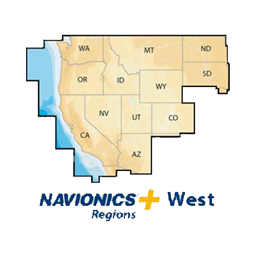
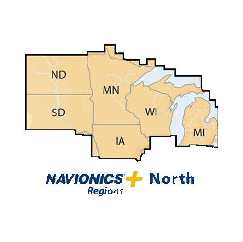
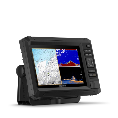
When selecting nautical charts, it’s important to consider the area you’ll be travelling, the type of vessel you operate, and your preferred navigation methods. Coastal explorers may favour large-scale charts that provide intricate details of bays and harbours, while long-distance cruisers might opt for charts covering broader regions. Many mariners choose to supplement traditional charts with electronic navigation aids, enhancing their situational awareness and route planning capabilities. For those interested in upgrading their navigation setup, exploring options like Marine Chartplotters can offer advanced features, including integration with digital charts and real-time data overlays. Whether you’re preparing for an early-season adventure or planning ahead for warmer weather, investing in the right nautical charts ensures every journey is guided by accurate, reliable information—helping you make the most of Canada’s extraordinary waterways, year-round.
For those who love to spend time on the water, nautical charts are indispensable tools that bridge tradition and technology. Experienced mariners often appreciate the tactile reassurance of a classic paper chart, which can be spread out on a galley table for route planning or quickly referenced in the cockpit. The symbols and colour codes on these charts become second nature over time, guiding navigation decisions and anchorage choices. Meanwhile, digital charts offer the convenience of real-time updates and integration with GPS-enabled devices, making them an excellent choice for tech-savvy boaters and those who prefer seamless connectivity. Families planning a summer voyage, fishing enthusiasts seeking the best spots, and even new boat owners can all benefit from understanding how to interpret the detailed information provided by nautical charts. These charts also make thoughtful gifts for anyone passionate about boating, sailing, or maritime history—imagine the delight of a friend or family member unrolling a beautifully detailed chart of their favourite cruising grounds.
When selecting nautical charts, it’s important to consider the area you’ll be travelling, the type of vessel you operate, and your preferred navigation methods. Coastal explorers may favour large-scale charts that provide intricate details of bays and harbours, while long-distance cruisers might opt for charts covering broader regions. Many mariners choose to supplement traditional charts with electronic navigation aids, enhancing their situational awareness and route planning capabilities. For those interested in upgrading their navigation setup, exploring options like Marine Chartplotters can offer advanced features, including integration with digital charts and real-time data overlays. Whether you’re preparing for an early-season adventure or planning ahead for warmer weather, investing in the right nautical charts ensures every journey is guided by accurate, reliable information—helping you make the most of Canada’s extraordinary waterways, year-round.
Top selling and popular products
-
 Your price for this item is $776.86
 -
 Your price for this item is $73.09
 -
 Your price for this item is $23.99
 -
 Your price for this item is $16.45
 -
 Your price for this item is $955.4
 -
 Your price for this item is $870.24
 -
 Your price for this item is $2088.92
 -
 Your price for this item is $39.97
Discover more categories related to Nautical Charts
-
Navigation Maps
"Love it thank you best buy. Great service love the website"
-
Marine Chartplotters
-
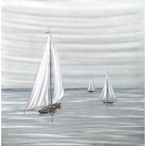
Nautical Wall Art
-
Boat Navigation Systems
Top Collections:
RAM Upgrades for PC, Best Laptops for Home Use, Best Type C Hub, Top Laptops, Best Wi-Fi Routers, Kindle Devices, Best Noise Cancelling Headphones, Best Black Friday Deals On Electronics, Best Quality Doorbell Cameras, Apple iPhones 16
Some products may be subject to Environmental Handling Fees
(EHF) depending on your province.
Learn more about EHFs.